 |
So Many Places To Visit!
|
------- |


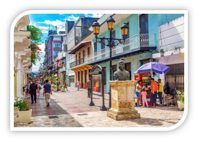
Santo Domingo |
SANTO DOMINGO -- CULTURAL SITE -----------------115[ARTICLE] | |||
Eagles Bay, Dominican RepublicBy Estefanía Muriel for Ruta Pantera on 7/24/2025 9:12:52 AM |
||||
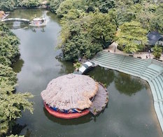
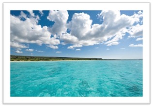
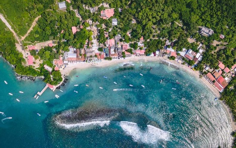
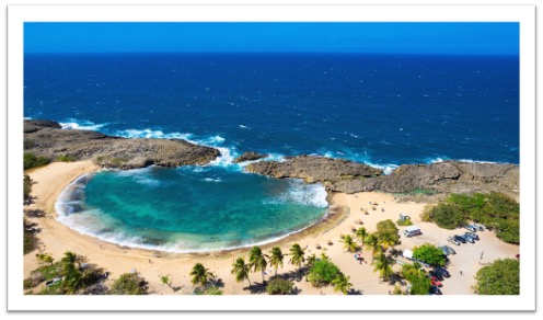
| In the southwestern tip of the Dominican Republic, in the province of Pedernales, lies Bahía de las Águilas, a pristine jewel of the Caribbean Sea and part of Jaragua National Park. With more than seven kilometers of white, unbuilt beach surrounded by an arid, semi-desert landscape, it is considered one of the most beautiful beaches in the Caribbean. Its natural history is linked to environmental protection: in 1983, Jaragua National Park was declared a Biosphere Reserve by UNESCO, in recognition of its significant terrestrial and marine biodiversity. Unlike other Dominican tourist areas, this region has remained almost untouched thanks to its remoteness and environmental regulations, which have allowed it to remain a valuable natural sanctuary. | ||||

|
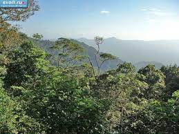
What makes Bahía de las Águilas unique Bahía de las Águilas is part of an ecosystem that is home to more than 130 species of birds, several endangered sea turtle species, and a coral reef rich in marine life. The beach is within a protected area, meaning there are no buildings or services: it's almost like a desert facing the sea. Access is limited, which has helped preserve its unspoiled beauty. Its name has no documented origin related to specific birds, but it is presumed to be due to the presence of birds of prey in the region. | |||

|
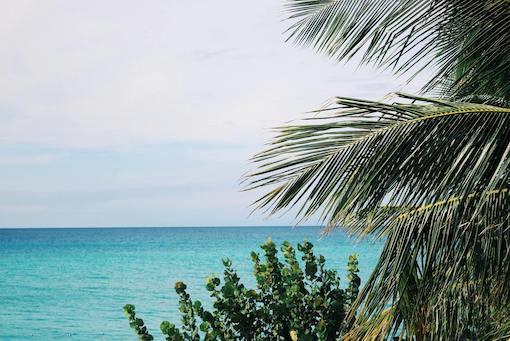
Highlights you can't miss One of the must-sees when visiting Bahía de las Águilas is the boat tour from Cabo Rojo, where small boats take visitors along the cliffs for about 15 to 20 minutes. The trip costs between $15 and $25 per person, depending on the number of passengers. Once on the beach, snorkeling is a must: the crystal-clear waters allow you to see tropical fish, sea urchins, and coral right on the shore. Although there are no restaurants in the bay, in Cabo Rojo you can have lunch at the Cueva de las Águilas restaurant, where the most popular dish is fried fish with tostones and salad, for an average price of $12 to $15. Although the region doesn't have widely celebrated traditional festivals, cultural activities and community events are organized throughout the year in Pedernales, especially during national holidays like February and August. These celebrations often include delicious dishes from the local cuisine, music, and sports activities. Options to continue discovering A short distance from the bay are other attractions worth visiting. Jaragua National Park offers trails to observe endemic flora and caves with Taíno rock art, such as the Guanal Cave. Entrance to the park costs a nominal 100 Dominican pesos (about $1.70 USD). In Pedernales, the Jaragua-Bahoruco-Enriquillo Biosphere Reserve Eco-Museum offers information on the region's natural history. Another notable attraction is the Sierra de Bahoruco National Park Visitor Center, located about two hours from Pedernales, where you can observe montane ecosystems, cloud forests, and a variety of endemic birds. Admission costs approximately 150 Dominican pesos (about $2.60 USD). This site offers a different view of the ecosystem, moving from arid zones to humid forests, all within a single day. The best way to access the place From Santo Domingo, the drive to Bahía de las Águilas involves approximately 325 kilometers to Pedernales, which takes between 6 and 7 hours by private vehicle. Traveling along the Barahona-Enriquillo Highway is recommended, offering views of the sea and mountains. Although there are buses from the capital to Pedernales (for example, Caribe Tours, for about 600 Dominican pesos or $10 USD), reaching the bay requires an all-terrain vehicle or local transportation from Cabo Rojo. Boats to access the beach depart from the "La Cueva" pier. As for accommodations, there are options for all budgets. In Pedernales, there are simple hotels from $25 to $40 per night, while in Cabo Rojo, there are eco- lodges like " Glamping Cueva de las Águilas," with beachfront tents from $100 to $150 per night, including breakfast. The best time to visit Bahía de las Águilas is between December and April, when the weather is dry and temperatures are more pleasant. In summer, although hot, there are fewer tourists and lower prices. Practical and safety tips As this is a pristine beach, there are no restrooms or much shade, so it's recommended to bring umbrellas, drinking water, biodegradable sunscreen, and trash bags. Access can be difficult during heavy rains, so it's best to check the weather before traveling. It's a safe area, but it's important not to leave valuables on the beach or walk at night on lonely paths. We also recommend hiring regulated local tour services to ensure a safe and sustainable experience. | |||
| --rutapanter.com-- |
| Instagram: | Email contact: | Interest area: Beach and Sun |

The San Juan Islands, United States
Located in the far northwest of Washington state, near the Canadian border and between the mainland and Vancouver Island, the San Juan Islands are an archipelago of mor [read more.]
Whistler, Alabama, United States
Whistler is a small community located in Mobile County, Alabama, in the southeastern United States. It is not a traditional tourist town or a mass tourism destination, [read more.]

Vancouver, United States
Vancouver is a city located in Washington state, just north of the Columbia River and across the river from Portland, Oregon. Although many people confuse it with the f [read more.]
Napa Valley, California. United States
Napa Valley is one of the world's most prestigious wine regions, located in Northern California, approximately 80 kilometers from San Francisco. Its modern history be [read more.]
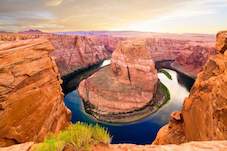
Grand Canyon, United States
The Grand Canyon is one of the most iconic natural landmarks in the world, located in northern Arizona and carved over millions of years by the Colorado River. Stretchi [read more.]

Salt Lake City, United States
Salt Lake City is the capital of the state of Utah and the cultural and economic center of the region known as the Wasatch Front. Founded in 1847 by Mormon pioneers led [read more.]
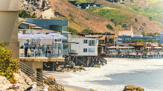
Malibu, United States
Malibu is a coastal city located in the state of California, about 30 miles west of downtown Los Angeles. Known for its scenic beaches, Pacific Ocean cliffs, and celebr [read more.]
To see more Waypoints in North America, please become a member here.
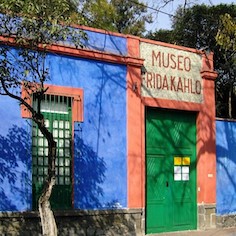
The Frida Kahlo Museum
The Frida Kahlo Museum, known worldwide as the Blue House, is located in the heart of Coyoacán, one of Mexico City’s oldest and most culturally rich neighborhoods. B [read more.]
Dominica, Caribbean
Dominica is an island country located in the Lesser Antilles of the Caribbean, situated between the French islands of Guadeloupe (to the north) and Martinique (to the south). Its capital and [read more.]
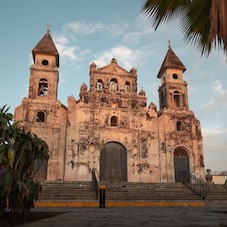
Granada, Nicaragua
Granada, also known as the "Great Sultana," is one of Nicaragua's most prominent colonial cities, renowned for its abundance of churches and religious facades. Founded in the 16th century, [read more.]
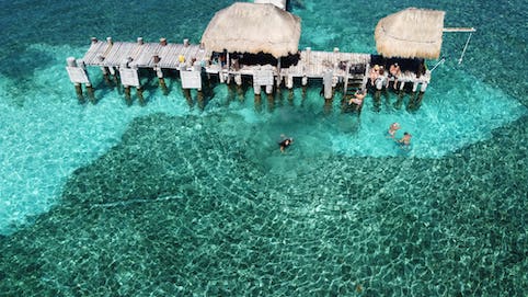
Isla Mujeres, México
Off the coast of Cancún, just 19.7 kilometers across the Caribbean Sea, lies Isla Mujeres, “a small paradise where Mayan history, island tranquility, and sustainable tourism converge” ( [read more.]
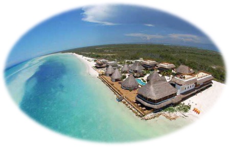
Holbox Island, Mexico
Holbox Island, whose name means "black hole" in Mayan and is pronounced "hol-bosh," is a peaceful island located in the Yucatán Channel, north of the peninsula, in the state of Quintana Roo [read more.]
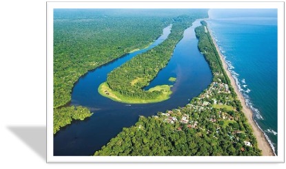
Barra del Colorado, Costa Rica
Barra del Colorado is a remote enclave located on the northeastern tip of Costa Rica's Caribbean coast, in the province of Limón, bordering Nicaragua. It has been protected as a National [read more.]
Zihuatanejo, Mexico
Zihuatanejo is a former fishing village located in the bay of the same name, surrounded by the Sierra Madre del Sur mountains. It developed alongside Ixtapa since the 1970s, but retaining it [read more.]
To see more Waypoints in Central America, please become a member here.
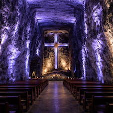
The Salt Cathedral of Zipaquirá, Colombia
The Salt Cathedral of Zipaquirá is an underground temple carved into a former salt mine, located in the Salt Park on the outskirts of Zipaquirá (Cundinamarca). Its modern architecture comb [read more.]

Christ the Redeemer, Rio de Janeiro
Christ the Redeemer stands atop Corcovado Mountain, within Tijuca National Park, dominating the Rio de Janeiro skyline with an imposing and serene presence. This monumental statue, 30 meters [read more.]
Fernando de Noronha, Brazil
Fernando de Noronha is a small volcanic archipelago in the South Atlantic. It is famous for its golden sand beaches, crystal-clear waters, and abundant marine life; much of the territory (ap [read more.]
Florianópolis, Brazil
Florianópolis, affectionately known as Floripa, is the capital of the state of Santa Catarina, located partly on Santa Catarina Island and partly on the mainland in southern Bra
[read more.]

Chapada Diamantina, Brazil
Chapada Diamantina National Park, created in 1985 and managed by ICMBio, protects over 152,000 hectares of the Serra do Sincorá mountain range in the state of Bahia. Its territory encompass [read more.]
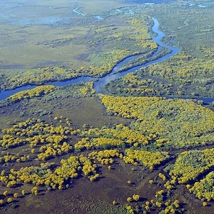
The Great Pantanal, Brazil
The Gran Pantanal is the world’s largest expanse of tropical wetlands, a vast territory of floodplains that extends primarily across the Brazilian states of Mato Grosso do Sul and Mato Gro [read more.]
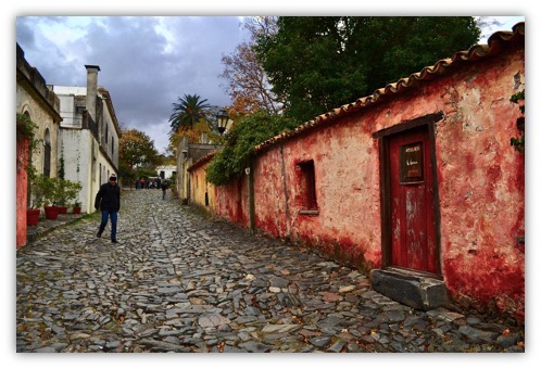
Sacramento Colony, Uruguay.
Colonia del Sacramento, on Uruguay's western coast opposite Buenos Aires, is a magnet for those seeking photogenic charm, cobblestone streets, and a leisurely pace. Founded by the Portugue [read more.]
To see more Waypoints in South America, please become a member here.
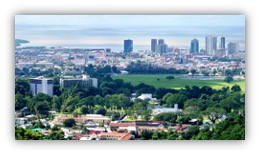
Port of Spain, Trinidad and Tobago
Puerto Rico
The Colonial Capital of Santo Domingo
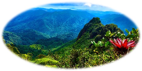
El Yunque, Puerto Rico
Eagles Bay, Dominican Republic
To see more Waypoints in The Caribbean, please become a member here.

|
Waypoint Finder (Over 1,000 destinations in PanAmerica) |
|---|